


Unmaned Surface Vehicles
Echo Sounders
Side Scan Sonars
Underwater Sensor
Acoustic Doppler Current Profilers
Marine positioning equipment
Total Stations
Electronic Theodolites
Digital Levels
Automatic Levels
Handhelds Distance Meters
Prisms/Tripods/Poles/Staffs...
Mapping Drones & Payloads
UAV Applications
AcuteLas Studio Software
Terrestrial Laser Scanners
LiDARs
SLAM LiDAR
Satellite Imagery
Automatic Deformation Monitoring Systems
Environmental Monitoring Systems
Relevant Sensors
Pipe & Cable Locator
VR Simulated Surveying Training Systems
Auto Steering
Track Geometry Measuring Trolley Systems
Automated Tunnel Scanning & Inspection Systems

Features
Specification

| GNSS Features |
Channels | 1698 (1808 is optional) |
| GPS | L1C, L1C/A, L2C, L2P(Y), L5 | |
| GLONASS | G1, G2, G3 | |
| BDS | B1I, B2I, B3I, B1C, B2a, B2b | |
| GALILEO | E1, E5a, E5b, E6, AltBOC* | |
| SBAS | L1* | |
| IRNSS | L5* | |
| QZSS | L1, L2C, L5* | |
| MSS L-Band* | BDS PPP/ Galileo HAS | |
| Positioning Output Rate |
1Hz~20Hz |
|
| Initialization Time | < 10s | |
| Initialization Reliability | >99.99% | |
| Positioning Precision |
Code Differential Positioning |
Horizontal: 0.25 m + 1 ppm RMS Vertical: 0.50 m + 1 ppm RMS |
| GNSS Static | Horizontal: 2.5 mm + 0.5 ppm RMS Vertical: 3.5 mm + 0.5 ppm RMS |
|
| Static (Long Observation) |
Horizontal: 2.5 mm + 0.1 ppm RMS Vertical: 3 mm + 0.4 ppm RMS |
|
| Rapid Static | Horizontal: 2.5 mm + 0.5 ppm RMS Vertical: 5 mm + 0.5 ppm RMS |
|
| PPK | Horizontal: 3 mm + 1 ppm RMS Vertical: 5 mm + 1 ppm RMS |
|
| RTK(UHF) | Horizontal: 8 mm + 1 ppm RMS Vertical: 15 mm + 1 ppm RMS |
|
| RTK(NTRIP) | Horizontal: 8 mm + 0.5 ppm RMS Vertical: 15 mm + 0.5 ppm RMS |
|
| SBAS Positioning | Typically<5m 3DRMS | |
| RTK Initialization Time |
2~8s | |
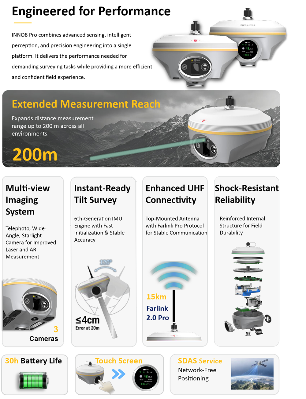
| IMU Tilt Angle | 0°~ 120° | |
| Hardware performance | Dimension | 155mm(φ)×93.6mm(H) |
| Weight | 1280g (battery included) | |
| Material | Magnesium aluminum alloy shell | |
| Operating Temperature |
-45℃~+75℃ | |
| Storage Temperature |
-55℃~+85℃ | |
| Humidity | 100% Non-condensing | |
| Waterproof/ Dustproof |
IP68 standard, fully protected against blowing dust |
|
| Shock/Vibration | Withstand 2 meters pole drop onto the cement ground naturally |
|
| Power Supply | 6-28V DC, overvoltage protection | |
| Battery | Inbuilt 7.4v 10,000mAh echargeable Lithium-ion battery |
|
| Battery Life | 30h |
|
| Communications | I/O Port |
5-PIN LEMO interface (external ower port + RS232) Type-C interface (Charge+OTG+Ethernet) UHF antenna interfaceSIM card slot (Micro SIM) |
| Internal UHF | 3W Radio receiver and transmitter | |
| Frequency Range | 410-470MHz | |
| Communication Protocol |
Farlink, Trimtalk, SOUTH, HUACE, Hitarget | |
| Communication Range |
Typically 8-10km with Farlink protocol (12-15km in optimal condition) |
|
| Cellular Mobile Network |
4G |
|
| Bluetooth | Bluetooth 5.0, 3.0/4.2 standard, Bluetooth 2.1 + EDR |
|
| NFC Communication | Support |
|
| Modem | 802.11 b/g/n standard |
|
| Data Storage/Transmission | Storage | 64GB SSD internal storage Automatic cycling storage Support external USB storage (OTG) The customizable sample interval is up to 20Hz |
| Data Transmission | Plug and play mode of USB data transmission Supports FTP/HTTP data download |
|
| Data Format | Static data format: STH, Rinex2.01, Rinex3.02 and etc. Differential data format: RTCM 2.1, RTCM 2.3, RTCM 3.0, RTCM 3.1, RTCM 3.2 GPS output data format: NMEA 0183, PJK plane coordinate, Binary code Network model support: VRS, FKP, MAC, fully support NTRIP protocol |
|
| Sensors | IMU |
calibration-free, up to 120°, refresh rate 400 Hz, pitch & roll accuracy 0.05 °,heading accuracy 0.15° |
| Camera |
Video shooting camera: 8MP Laser aiding telephoto camera: 8MP AR stakeout camera: 2MP |
|
| Laser | 3R green laser, 150m range (200m in optimal condition) | |
| Electronic Bubble |
Controller software can display electronic bubble, checking leveling status of the carbon pole in real-time |
|
| Thermometer | Built-in thermometer sensor, adopting intelligent temperature control technology, monitoring and adjusting the receiver temperature |
|
| User Interaction |
Operating System | Linux |
| Buttons | Dual buttons | |
| Indicators | Satellites, data and power indicators | |
| Display | 1.39’ circular LED touchscreen,454*454 pixel | |
| Web Interaction |
With access to Web UI via WiFi or USB connection, users can monitor the receiver status and change the configurations |
|
| Voice Guidance |
Chinese/English/Korean/Spanish/ Portuguese/Russian/Turkish/French/ Italian |
|
| Secondary Development |
Provides secondary development package, and opens the OpenSIC observation data format and interaction interface definition |
|
| Cloud Service | The powerful cloud platform provides online services like remote management, firmware updates, online registers, etc. |
23